|
Olinghouse
Canyon
September, 2007
By John Evanoff
In the early fall, I like to hike the hills around Reno to view
the Truckee Meadows and the glorious autumn color changes. A good
SLR camera is a necessity to pack so you don’t miss the splendid
shots you only see in postcards.
Some of these hikes are east of Reno along the
Pah Rah Range. You can get there by several routes, but one of the
more interesting because of its hidden nature is from Olinghouse
Canyon. Drive east on Highway 80 to the Pyramid Lake turnoff at
SR 427 which leads you to Wadsworth and then take the left at SR
447 through to the Pyramid Lake Indian Reservation. About a half-mile
past the reservation entrance, you’ll take a left at Olinghouse
Road. This road goes west to several other Olinghouse Roads that
meander along the hillside. Olinghouse was named after a sheep herder
who called this side of the Pah Rah Range his home for a decade
until gold was discovered in the hills in the 1870’s. But
miners never really organized in the region until 1892 because of
the minute amounts of gold and the necessary expense of extracting
it in mass to generate enough revenue to pay for their venture.
If you keep going up the road, you’ll see
some shacks in a small canyon with some mining pits behind it. Although
Olinghouse is actually further up the canyon, the Olinghouse mining
district covering many square miles around Green Hill contains more
than 20 abandoned and working crystallized gold mines that have
produced as much as a half million dollars over the course of their
short lives between 1898 and 1907. There was even a small narrow
gauge locomotive line between the Wadsworth stamp mill and Olinghouse
for a few months in 1907, but the prospectors left when pyrite (fools
gold) became just about the only mineral dug out of the ground for
eight months straight. It is important to note this is private property
in many areas. The Keystone, Renegade, Gold Center and Tiger Mines
are still posted and protected by their owners. You must not enter
without permission from the owners and the likelihood of that is
minimal. What you can do is take one of the small roads leading
north off the main road along Green Hill to the left up any of the
other canyons. Olinghouse Canyon goes all the way to the ridge line
and many of the other canyons meet there also. You’ll see
all sorts of prospecting mounds as you meander along the hillside
until you reach Tiger Canyon. I like this route to the top of Spanish
Spring Peak at 7,404 feet, Pond Peak at 8,035 feet, Virginia Peak
at 8,366 feet and Pah Rah Peak at 8249 feet because of its nearness
to the Truckee Meadows and its history. It is thought that a band
of Pyramid Lake Paiute Indians used a spot at Tiger Canyon to spy
down on Major William Ormsby on May 12, 1860 and 105 ill-equipped
drunken miners and townsmen of Virginia City, Gold Hill, Silver
City, Dayton, Carson City and Genoa bent on wiping out every Indian
in their path. The exact opposite happened when more than 600 angry
braves of the Northern Pauite and Shoshone met the farce of an infantry
and massacred most of them at the Bluffs just a few miles north
of Olinghouse along the Truckee River. The Paiute Chief Numaga,
known as Young Winnemucca tried to stop the battle, but the braves
would not listen to him because they had been met with force before
and knew of Ormsby’s intentions. The whole nasty business
started when three white men kidnapped two Indian girls at Williams
Station 30 miles east of Carson City a few weeks earlier and were
killed when they would not return them to the Indian family living
in the area. The resulting storm of wild rumors left the residents
of the entire area between Genoa and the Oregon border panicky and
wondering when the next attack would happen. Less than a month later,
a regiment of 754 soldiers under the command of a Colonel Hays with
15 companies consisting of infantry, artillery and cavalry converged
on the tribe and killed or maimed a hundred sixty Indians in retaliation.
The fight by the tribe was long and arduous and only meant as a
delaying tactic to aid in allowing the women and children enough
time to flea to the north. Many of the Pyramid Lake Tribe escaped
into the hills north of the Smoke Creek Desert and came back within
the next year when a truce was made at Nixon. Young Numaga only
wanted peace with the whites and was heralded as a great strategist
by Hays and his officers for his hard fought stand at what is now
known as Marble Bluff. Numaga went on to become very well respected
by settlers, politicians and the cavalry.
There are several canyons to explore along the
route including Tiger, White Horse, Fort Defiance and Secret Canyon.
This set of canyons is almost fifteen miles long and I would take
one at a time because of the expanse between each of the higher
peaks including Virginia, Spanish Springs, Pond and Pah Rah. All
of them are strenuous hikes leading to many canyons, mini-valleys
and black lava cliffs along the way. The canyons are usually dry
except for the spring outlets where the quail, chucker, sagehen,
cottontail, jackrabbit and deer converge to water in the mornings
and evening. There are many trails between prospector’s pits
and tailings which wind their way around and up the sides of all
the canyons and through to the ridgelines. Pick any and you will
eventually end up at the top of the Pah Rah Range and Virginia Peak
and further north to Pah Rah Peak, Pond Peak at the center of the
range or Spanish Springs Peak to the south in the range. You will
also see a few mustang in these hills.
If you haven’t the time for these hikes,
there are several four wheel drive roads from the Spanish Springs
side off of Vista Blvd on Hansberry Lane or from the Pyramid Lake
Highway at Little Hungry Valley south of Palomino Valley to the
east on Ironwood Road until you reach the end of the Wilcox Ranch
Road. The Little Hungry Valley roads are the better of the two and
the Wilcox Ranch Road winds up Wilcox Canyon or Hay Canyon all the
way to Pond Peak.
Whatever way you go, take your time and view the
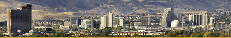
surrounding sights. From Spanish Springs and Virginia Peak, you
can see most of the path of the Truckee River from Verdi all the
way to Pyramid Lake. The view of the Spanish Springs Valley and
the Truckee Meadows will take your breath away at sundown and early
morning is glorious as the sun hits Mount Rose, Slide Mountain and
Peavine Peak and then lights the rest of valley with autumn shades
of red, orange and gold. Ancient man traversed the Pah Rah range
following the herds of deer and elk from the higher peaks to the
Truckee River and evidence can be found in a few places of their
writings call glyphs.
Some seismologists believe this area is the most
prone fault for the next 6.0 or higher seismic event because of
the uplift measured and analyzed from the last ten thousand years
here. Major earth movements known as rifts, lifts and thrusts have
occurred in this active fault zone every fifty years and the last
large one occurred in 1938. The Olinghouse Fault is due for a major
earthquake soon and it will most probably dramatically affect those
who live in the Truckee Meadows. Some trenches have been dug along
the Olinghouse Road that show ancient scars of shearing and uplift
as much as ten feet in one movement.
For the hardy hiker, horseback rider or mountain
biker, this ridge line is magnificent for its views of the entire
Truckee Meadows, the Truckee River from Verdi to Pyramid Lake and
the Mount Rose summit and the Sierras Nevada Range with its early
fall colors. As always, take enough food and water for a couple
days and be prepared with a first aid kit. Oh, and take binoculars
too.
Next month, I’ll write about the town that
moved almost overnight to become our sister city of Sparks. Wadsworth
was the main supply station of the Central Pacific railroad for
36 years and the Big Bend saw more pioneers trudge through its streets
in 50 years between 1850 and 1900 than almost any other town in
the west.
|